Utah Drawn: An Exhibition of Rare Maps
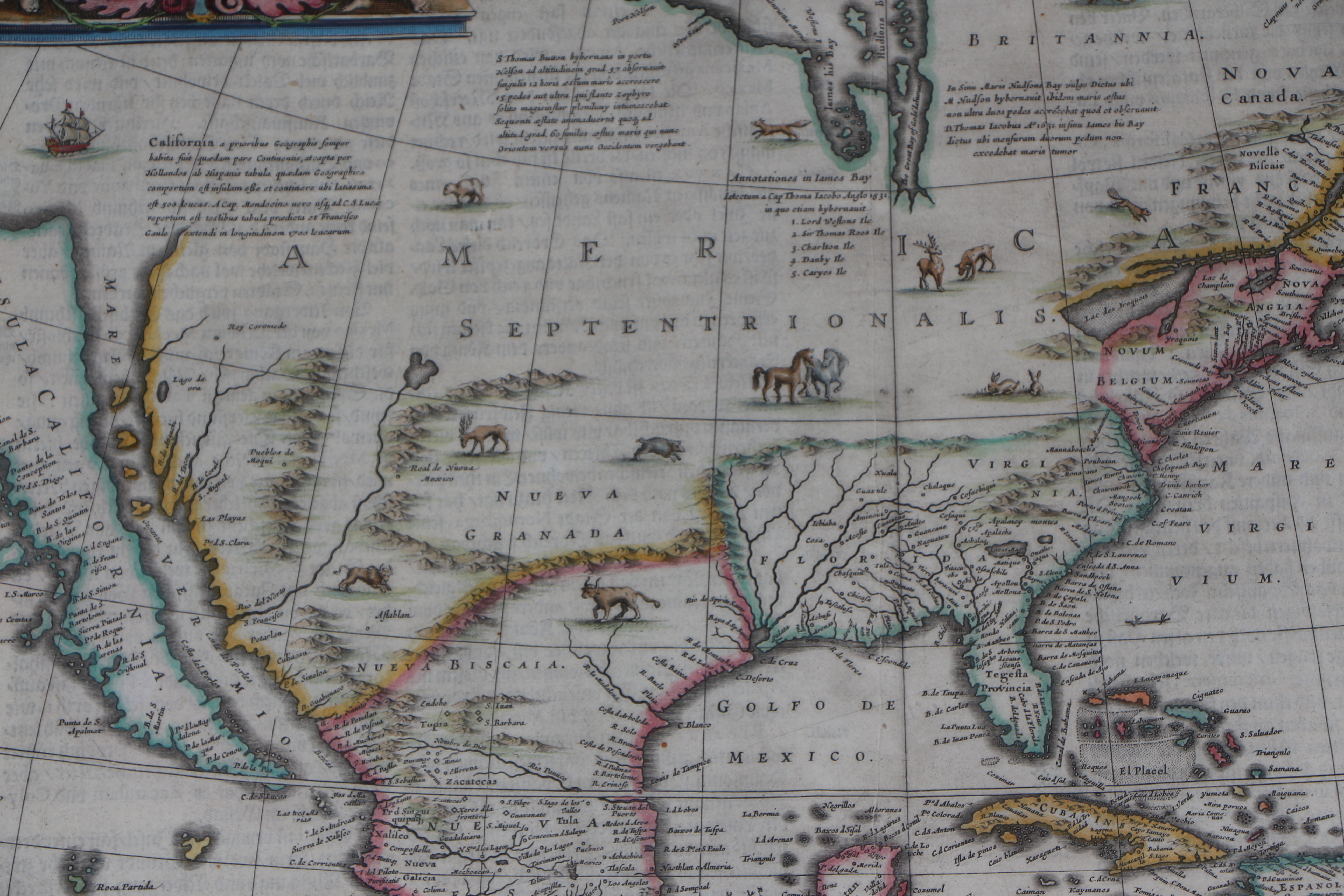
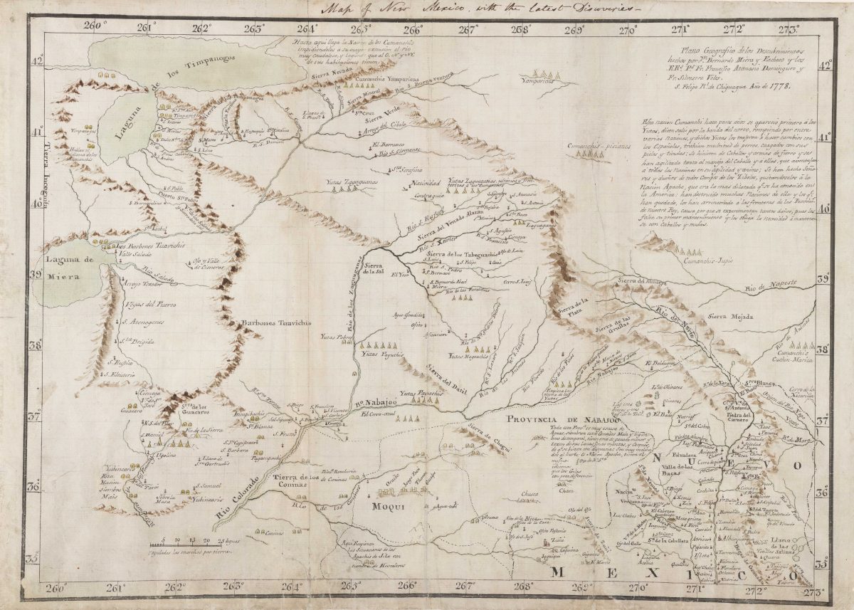
The six maps reproduced below are part of Utah Drawn: An Exhibition of Rare Maps displayed in the Utah Capitol Building in 2017.
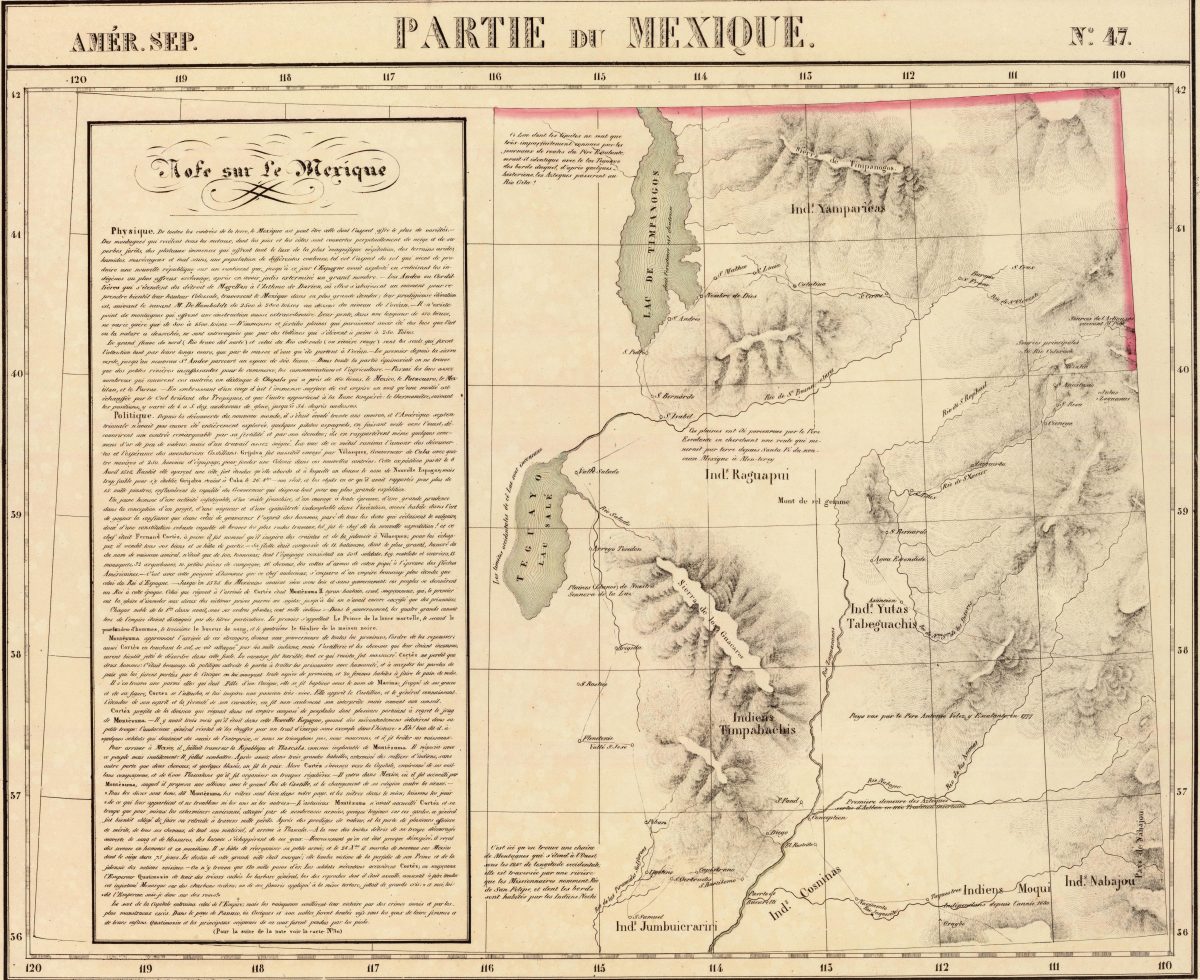
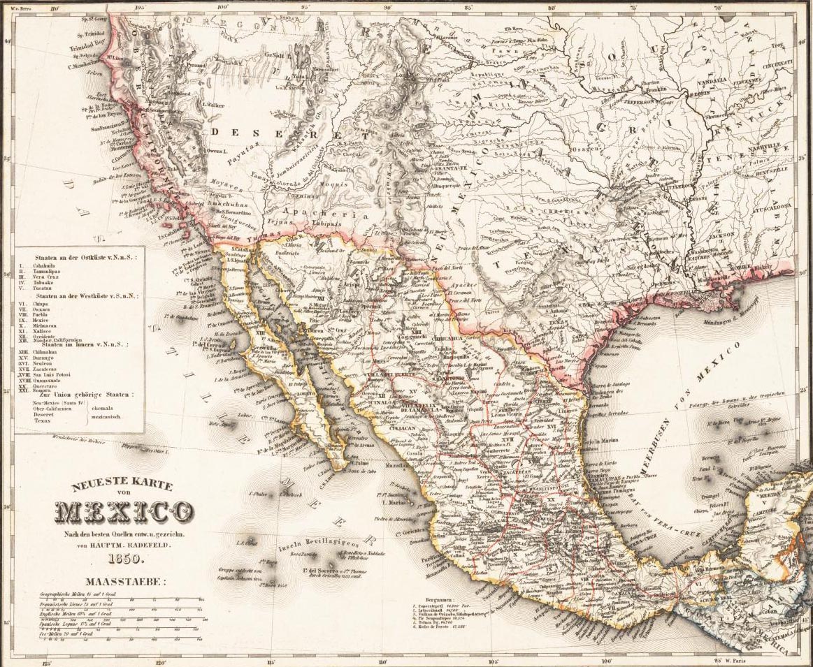
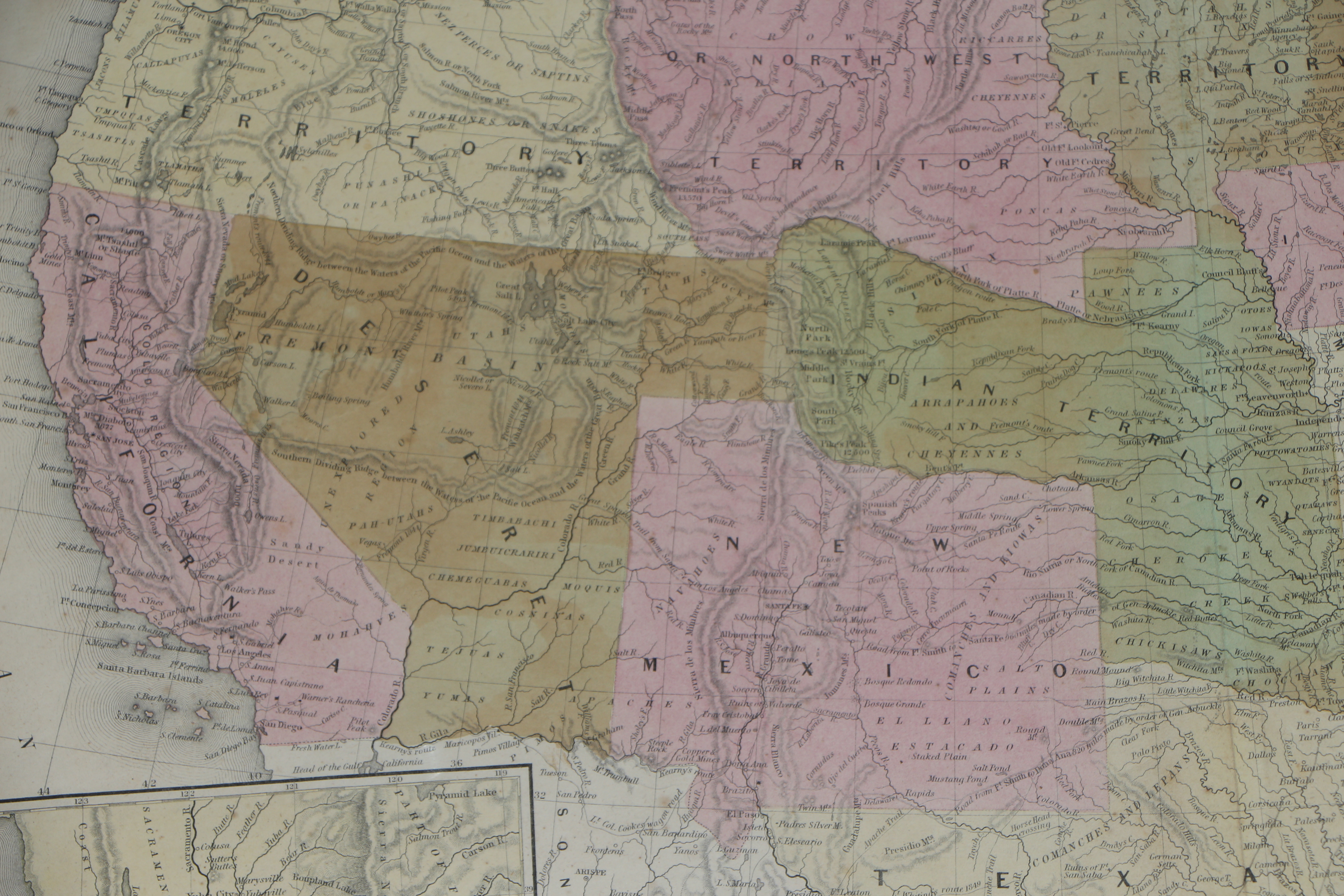
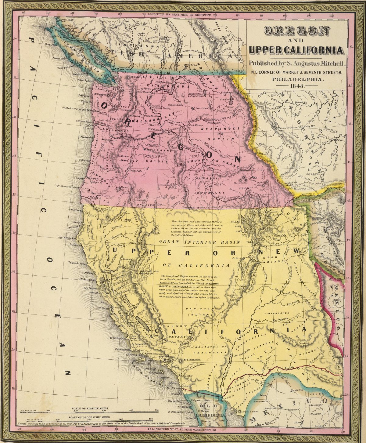
Maps serve many purposes. They represent physical geographies, recording landmarks, routes, and boundaries. But they also reflect varying perceptions, imaginations, values, and aspirations. This is certainly true of the maps presented here. Over five centuries, empires and explorers along with printers and publishers worked first to trace the outline of a continent that was new to Europeans and then, eventually, to fill in its vast middle. These maps show the steady increase of geographic knowledge of the Americas, but they also demonstrate the economic and political interests that produced that knowledge and the individuals who benefited from it. They hint at what map makers and their sponsors determined was worth documenting, identifying, and, in some cases, possessing. They often erase, obscure, and distort. Put simply: maps are more than cartographic representations of known or imagined physical features on the landscape. As you examine these maps, try to determine the purposes for which they were made and any mistruths, omissions, and distortions they may contain.
Original maps shown are from the private collection of Salt Lake City businessman Stephen Boulay, with additional contributions from the Utah State Historical Society, LDS Church History Department, L. Tom Perry Special Collections at Brigham Young University, Special Collections at the J. Willard Marriott Library, and the American West Center at the University of Utah.
Maps on the Hill Archive