Christopher W. Merritt, Ph.D., State Historic Preservation Officer
With trembles strong enough to shake “the dignity out of all judicial procedures,” [i] at Salt Lake City’s courts, the 6.6 magnitude earthquake rattled homes, businesses, and nerves from Boise, Idaho to Richfield, Utah and Rock Springs, Wyoming to Elko, Nevada. Dr. Frederick J. Pack, geologist with the University of Utah called this the strongest earthquake in Utah’s recorded history and commented, “If there were worse ones, they were in prehistoric times”. In comparison, the earthquake striking Salt Lake County on March 18, 2020 reached what the author considers a more than sufficient magnitude of 5.7, damaging both property and our collective psyche.

Salt Lake County’s 2020 earthquake, whose epicenter was near downtown Magna, damaged well over 160 historic buildings and left several unfit for human occupation at least for a short while. And just like during the historic 6.6 magnitude earthquake, unfounded rumors swirled about a second major earthquake hitting the same afternoon of the March 18, 2020 earthquake, proving once again how history repeats itself much to our own dismay.
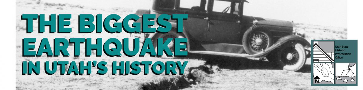
On March 12, 1934 at 8:05 a.m., the 6.6 magnitude earthquake struck and within seconds “an undulating from east to west swayed the city,” followed with an aftershock at 8:32 a.m. and a third at 11:21a.m., and each of those aftershocks registered above the 5.0 magnitude marks themselves. Frederick J. Pack was one of several geologists responding to the earthquake, and his diligent photographic work at the epicenter captured the historic nature of this quake.

Damage in Salt Lake City ranged from a crack in the cornice of Main Street’s Clift Building, a chimney collapsed and burst through a window at 817 E. 200 S., and the Angel Moroni on the Salt Lake Temple shifted slightly. The City & County Building was badly damaged with significant plaster and interior damage, and its chimney capstones dislodged and fell to the earth below. People and places across the region felt the effects of this massive earthquake. Companies shut down train traffic all the way to Evanston, Wyoming until inspectors cleared railroad tunnels, the Utah State Agricultural College (now Utah State University) noted that the quake “split three three-story brick economics building from top to bottom”, and a school in Preston, Idaho had one wall shift over 6” apart from the abutting walls. [ii]
There are many parallels between the two earthquakes, but also vast differences based on the strength of this 1934 quake and its location. Unlike the 2020 Magna earthquake, the epicenter for the 1934 quake was practically in the middle of nowhere on the northern shores of the Great Salt Lake near what is today’s Locomotive Springs Wildlife Management Area. Old railroad towns of Kelton and Kosmo, formed at the time of the Transcontinental Railroad’s completed in 1869, and a small airport crew at Locomotive Springs, represented the closest populated areas to the quake and aftershocks.
M.T Shore, agent for the Southern Pacific Railroad based in Kosmo at the time of the earthquake, recounted some of the impacts as “the interiors of homes at Kosmo, Locomotive Springs, and Kelton were all shaken into a topsy-turvy mass,” and “at least 40 gushing wells poured forth [water] on the ground and flooded an area of several hundred feet” at Kosmo.[iii]
This was not the first documented earthquake in the general area, as reports of one under the Great Salt Lake, came out of Kelton on December 28, 1880, complete with evidence of a small tidal wave hitting the mud flats.[iv] All this activity was, and still is, coming from under the Hansel Valley Fault, which extends in a northeast to southwest direction from Idaho towards Nevada and under Hansel Valley about 40 miles west of Tremonton, Utah. From documented records, there were nine earthquakes greater than magnitude 3.0 between the 1880 report and 1949, making it a relatively active fault in the Great Basin.[v]
Perhaps even more visually impressive than damaged buildings in Utah, massive tears in the surface of the ground stretched for at least five miles north and south in Hansel Valley and into the mud flats of the Great Salt Lake. Dr. Frederick J. Pack and his family toured the epicenter and provided startling images of heaved earth and massive cracks, some areas showing a 19” rise between sides of the crack. This makes the 1934 temblor the only known surface-faulting earthquake in Utah’s historic period.
Click the image below for a gallery of other 1934 earthquake photos.

Thankfully no one died or had any serious injuries from the March 18, 2020 earthquake, but in 1934 two deaths are directly attributed to the event. Ida May Venable Atkinson of Ogden died of a heart attack shortly after waking up to the earthquake, and Charles Bithel, a Salt Lake City Waterworks employee, died of internal injuries at LDS Hospital after a six-foot deep trench collapsed on him.
Utahns learned valuable lessons from the 1934 earthquake, and within a few years researchers established numerous seismograph stations around the state to better collect information on earthquakes. As Utahns we live in, around, and even upon active earthquake faults, and so it is important to plan ahead and find ways to protect your family and property. The Utah Division of State History’s State Historic Preservation Office created a brochure with some ideas on how to prepare your home for the next earthquake, and the Utah Division of Emergency Management’s website is an excellent resource on additional information for earthquake preparedness.
For more information on this and other earthquake history in Utah:
- See the Utah Historical Society’s “History Blazer” article on the 1934 quake written in 1995.
- Visit the University of Utah’s Seismograph Station website where Sheryl Peterson, Communications Specialist for the program, has compiled an amazing amount of historical information for you to dig deeper into the 1934 Hansel Valley event and other earthquakes.
- Read KSL News’ great summary article in 2012 on the “Five Biggest Earthquakes in Utah History”.
- Visit the Utah Seismic Safety Commission (USSC)’s robust website with lots of historic information, but also some great tools for preparing yourself for the next earthquake.
[i] “Worst Earthquake in History of State Rocks Utah Towns”, Richfield Reaper, March 15, 1934. [ii] “Earthquake Felt Here Yesterday”, Box Elder Journal, March 13, 1934 [iii] “Rail Agent Describes Earthquake at Kosmo”, Salt Lake Telegram, March 14, 1934. [iv] “Earthquake at Kelton”, Salt Lake Tribune, December 30, 1880. [v] “Earthquake Research and Knowledge: Hearing Before the Committee on Aeronautical and Space Sciences United States Senate, 94th Congress”, United States Printing Office. April 26, 1975.