The otherworldly landscape of Canyonlands National Park offers iconic images of hoodoo spires, sandstone cliffs, and desert vegetation. This gallery features striking images of Canyonlands, some from the Utah State Historical Society collection. Accompanying photos of natural scenery are images of people in what is one of Utah’s most remote places.
-
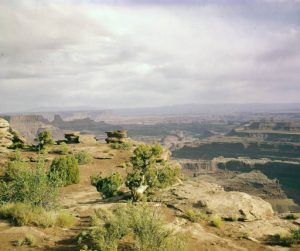
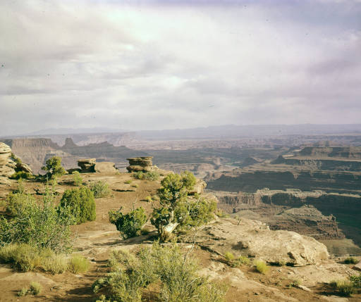
- Island in the Sky, ca. 1940s. USHS
-
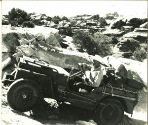
- Bates Wilson with jeep on Elephant Hill in what became Canyonlands National Park, 1950s. Photo courtesy of Alan Wilson.
-
- Chesler Park in Canyonlands, 1963-64. USHS
-
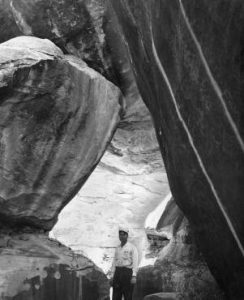
- George E. Jones, Monticello jeep enthusiast, in Devils Kitchen, Canyonlands, June 4, 1963. USHS
-
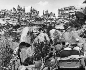
- Jeep party ascending steep pitch into Chesler Park, 1963-64. USHS
-
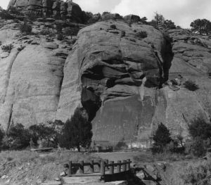
- Petroglyphs in Newspaper Rock State Park east of Canyonlands, n.d. USHS
-
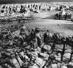
- Aerial photo of Chesler Park displaying multiple jeep roads. The Chesler Park reef of pinnacles is in the center of the picture running from the top to the middle. Jeep roads present in the photo that are no longer visible from ground level in the present time are indicated by the straight line crossing the photo to the left of the center of the reef, the line running adjacent to the left side of the bottom of the reef, and the several lines starting in the area near the bottom of the reef and running to the right. The photo appears to be from the late 1960s when such jeep paths were proliferating. Today the only remaining recognizable jeep path on the ground in Chesler Park was the primary entry of the jeep road that enters Chesler Park from the top left and heads towards the bottom part of the central reef.
-
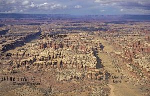
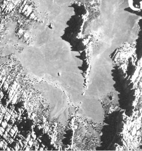
- Aerial photo of Cyclone Canyon and Devils Lane without the drawn in paved road that is presented in a figure in the article.
-
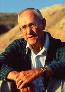
- Kimball Harper from his obituary in “Bulletin of the Ecological Society of America,” January 2012.
-
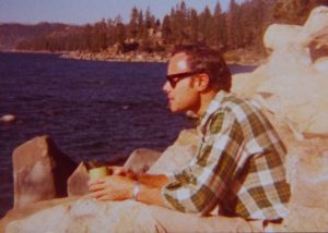
- Edgar F. Kleiner from 1973 while visiting Lake Tahoe. Courtesy of Edgar Kleiner.